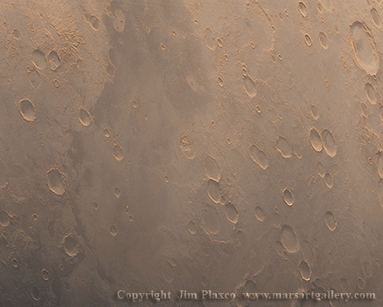
Planum Chronium

Image Title: Planum Chronium
Release Date: December 25, 2005
Source: Viking Orbiter 1
Description
Take a look at this image of a cratered Mars. What do you see? Plenty of craters. The larger crater in the upper right hand corner of the picture is named Mendel. Mendel Crater is almost 80 kilometers in diameter and is the only named crater in the image. In this image of craters and light colored terrain one area stands apart. That is the darker and slightly less cratered terrain that runs from top to bottom to the left of center. This is Planum Chronium
This area is named for the Cronian Sea which was the northern part of the World Sea here on Earth. The Cronian Sea's lack of winds to fill the sails made it a dangerous place for ships to venture. This sea is identified in Pliny the Elder's Natural History as being a frozen sea, a one day sail away from Thule.
Somewhat at odds with this area being named for a sea is its association with the descriptive term planum. With respect to the naming of features on Mars, a planum is an elevated region of land or a plateau. So technically what we have here is an elevated area that is named for a body of water. Somehow I find this both intriguing and refreshing.
Source Image Background
The image source used for this picture was captured by Viking Orbiter 1 in October 1976. It is centered on approximately 60° south latitude and 215° west longitude. The area shown is in the southern region of Terra Cimmerria in the Eridania quadrangle of Mars.
Image Processing
All processing of this image was done using Adobe Photoshop. This includes noise removal, tonal adjustments, and the application of false colors using a technique developed by the artist.
Wallpaper Download
I have created a compressed low resolution version of "Planum Chronium" for use as a desktop wallpaper. This wallpaper version is made available for your personal use only. It is not to be modified or redistributed in any form by any means. All rights are retained by the artist.


